
He wanted to backpack into an area he'd been to around 20 years ago, Fish Fork on the back side of Mount Baldy. It's a bit more than five miles, but gains & loses a lot of altitude on the way.

Unfortunately, that area is currently closed down. As an alternate, we selected the hike into Upper Bear. It's about the same distance and similar altitude gain & loss. I think this is my 5th time hiking back there, although it's probably been around 20 years since I've been to there, too!!! Once you get off the highway, there's really nothing developed except the trail (to varying degrees) and mile markers, so you have to take anything that you want to have with you.

He'd been training, hiking up and down a fairly steep hill in his neighborhood. I thought he'd be in the best shape for it of the three of us (myself & my oldest).

I'd forgotten how steeply it climbs at the start!!! In the first 1/3 mile or so, he was considering wrapping it up. I wasn't doing a lot better, but I was going to stick it out. We all continued on, though, and made it to Smith Saddle, the 3 mile mark, at the juncture between two peaks.

At that point, it was fairly late in the afternoon, and we decided to camp out right there with the plan of continuing on the next day. I'd remembered several large boulders in that area good for resting on, but none are there now.

The next morning we decided to leave our tent set up and our full frame packs and take my son's two day packs and do a day trip down to the actual creek. A short ways in, though, the trail was very loose and eroded, with a nasty looking slide down from there. My dad considered briefly, and decided to turn back. Not worried so much about crossing it going in as heading back with wobbly legs from the climb up.

My boy and I continued on, and there were a couple more slidy spots, then several small stream crossings, and we made it there in fairly short order. After a couple hours we headed back, which took considerably longer. Around 1000 feet of elevation change!!!
I took along my GPS to see what the distance traveled and altitude changes were, as well as to get the coordinates of the various points. The only one that seems to show properly on maps is the start, n34°17.243' w117°50.574'. If you check out the Google map of it on the satellite view zoomed in, you can see the parking area and the trail.

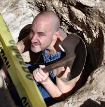
While we were camped, only saw three other people hiked in, a couple who were leaving when we arrived (thanks for taking the first picture!) and a guy by himself the next morning who went up to one of the peaks. No one at all while we were headed down to the creek.
I'd taken my old camera along, and got several good pictures, not all of which seem to want to post here currently. Blogger does seem to have picked the good ones to keep, though. On the way down to the creek there were some areas with many butterflies. Actually got a picture of a couple of them mating, and a short video of the same that I may post on YouTube.

The tent we had seemed too short to stretch out all the way in, and there were many flies and bitey insects, and it got quite cool at night. We all had a great time!!!
No comments:
Post a Comment